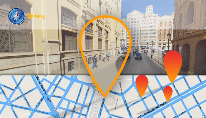
Microsofts web search engine Bing recently announced the latest update to Bing Maps. Users can now view over 100 cities through Streetside imagery and 3D maps. These new features allow users to preview certain landmarks such as the Gateway Arch, the Golden Gate Bridge, and the Las Vegas Strip.
We have been busy driving and flying to bring you more cities to view before you travel, stated the blog post. We recently surpassed the 100-city mark for both our Streetside imagery and our 3D cities, and there are a host of vacation favorites among them.
Among the cities and counties that are now available for viewing using Bing Maps new Streetside imagery are Boston, Montgomery, Napa County, Orlando, Philadelphia County, Raleigh, Madison, Buffalo, and Richmond. [See Figure 1 for the complete list of cities.]
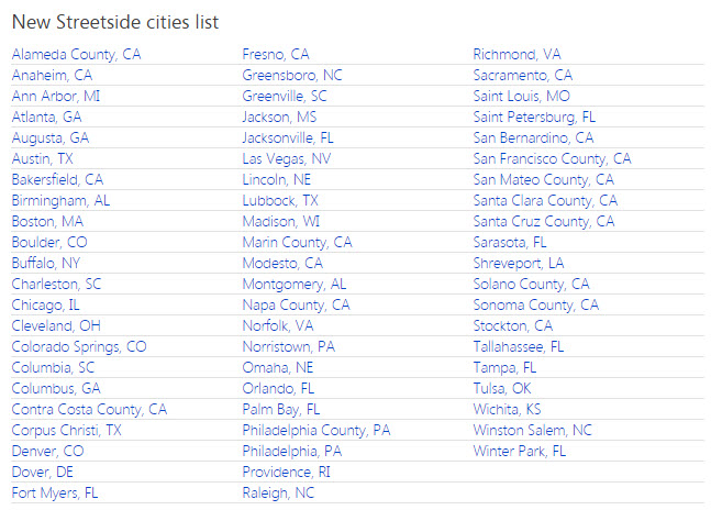
Figure 1
Travelers looking for close up views of their favorite city destinations can launch Streetside using either the Bing Maps app or the Bing Maps Preview app on Windows 8.1 [See Figures 2 and 3 for sample images using Streetside imagery]
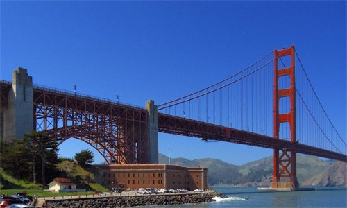
Figure 2
Golden Gate Bridge, San Francisco, CA

Figure 3
The Denver Center for Performing Arts, Denver, CO
In addition to its new Streetside imagery feature, Bing Maps also now supports over 125 highly detailed 3D cities worldwide using the Bing Maps Preview app. Some of these new areas include New Orleans, Atlanta, and Disney World in the United States; Copenhagen in Denmark; and Toronto and Vancouver in Canada. [See Figure 4 for the complete list of new 3D cities.]
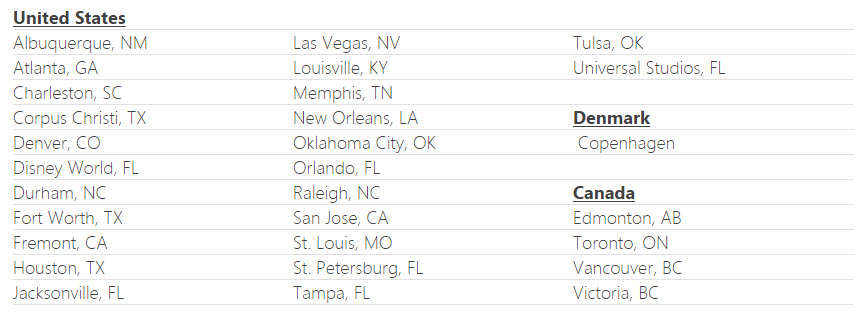
Figure 4
With the Bing Maps Preview app installed, users can simply click any city image to go directly to the 3D experience that they offer. The Bing Maps team advices users to keep checking back, as they are always trying to add new 3D cities to the list. [See Figures 5 and 6 for sample 3D cities.]

Figure 5
The Strip in Las Vegas, NV
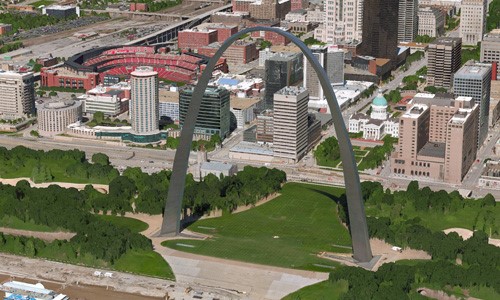
Figure 6
The Gateway Arch in St. Louis, MO
Bing Maps users across the globe can also look forward to the new and improved aerial imagery service. To date, over 150 countries covering five million square kilometers now offer new high-resolution aerial shots accomplished through satellites and aircraft-mounted cameras. [See Figure 7 for a sample aerial shot.]
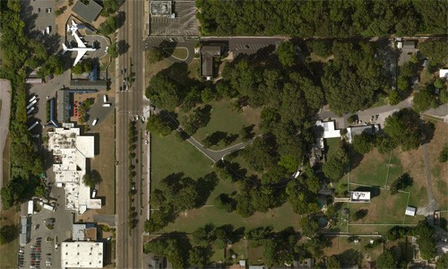
Figure 7
High-resolution aerial imagery of Graceland in Memphis, TN
For more information on Bing Maps new Streetside imagery feature, visit here.
What do you think of Bing Maps latest update? Will these new features help improve your travel experience? Let us know your opinions by leaving a comment below.
Comments
comments